Object
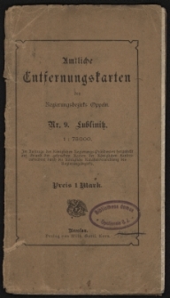
Title: Regierungsbezirk Oppeln. Amtliche Entfernungskarte des Kreises Lublinitz
Description:
[1] litografia ; 62x92 cm, mapa w ramce 58x86 cm ; Tytuł w prawym górnym rogu. Pod tytułem Im Auftrage des Königl. Regierungspräsidenten auf Grund der gedruckten Karten der Königl. Preuss. Landes-Aufnahme angefertig im Jahre 1904. Die Entfernungen sind katasteramtlich ermittelt und im Katasterbureau der Königl. Regierung geprüft.W lewym dolnym rogu objaśnienie znaków występujących na mapie. Skala 1 : 75 000 ; Na okładce złożonej mapy tytuł: „Amtliche Entfernungskarten des Regierungsbezirk Oppeln Nr. 9. Lublinitz”, a także owalna pieczęć z napisem w otoku: „Bibliotheca domus Oppoliensis”
Publisher:
Place of publication:
Format:
Resource Identifier:
Original Identifier:
Language:
Rights Management:
Wojewódzka Biblioteka Publiczna w Opolu
Object collections:
Last modified:
Nov 18, 2021
In our library since:
May 15, 2015
Number of object content hits:
53
Number of object content views in Mapa format
46
All available object's versions:
https://obc.opole.pl/publication/8078
Show description in RDF format:
Show description in OAI-PMH format:
| Edition name | Date |
|---|---|
| Regierungsbezirk Oppeln. Amtliche Entfernungskarte des Kreises Lublinitz | Nov 18, 2021 |


