Object
Title: Alt-Poppelau
Description:
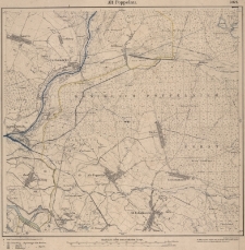
[1] mapa : litografia ; 60x56,5 cm, mapa w ramce 45x48 cm ; Miejscowości krańcowe: Kauern – (Stobrawa); Riebnig – (Rybna); Alt Schalkowitz – (Siołkowice); Chroczütz – (Chróścice) ; Tytuł nad górną ramką. Podziałka liniowa 4 cm na mapie = 1 km w terenie. Skala 1 : 25 000 ; W prawym górnym rogu nad ramką numer mapy 3021. Pod mapą w lewym dolnym rogu podano: Regierungs-Bez.Breslau: 114 kreis Brieg; Regierungs-Bez. Oppeln: 131 Kreis Oppeln, 132 Kreis Falkenberg
Publisher:
Königl. Preuss. Landes-Aufnahme 1883. Herausgegeben 1884. Berliner Lithogr. Institut
Place of publication:
Format:
Resource Identifier:
Original Identifier:
Language:
Rights Management:
Wojewódzka Biblioteka Publiczna w Opolu
Object collections:
Last modified:
Nov 18, 2021
In our library since:
May 8, 2015
Number of object content hits:
45
Number of object content views in Mapa format
44
All available object's versions:
https://obc.opole.pl/publication/8010
Show description in RDF format:
Show description in OAI-PMH format:
| Edition name | Date |
|---|---|
| ALT-POPPELAU | Nov 18, 2021 |