Object
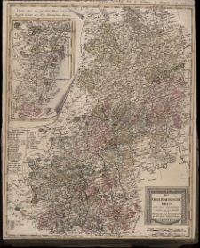
Title: Der Oberrheinische Kreis. Nach seinen Unterabtheilungen entworfen von F.L.Güssefeld
Description:
[1] mapa : miedzioryt kolorowany ręcznie ; 48x59 cm ; Deutsche od. Geographische Meilen 15 auf 1 Gr.: 7 mil - 9,8 cm [ok. 1 : 530 000]
Publisher:
Homännischen Erben Mit. Röm. Kayserl. Allergnäd. Freyheit
Place of publication:
Format:
Resource Identifier:
Original Identifier:
Language:
Rights Management:
Wojewódzka Biblioteka Publiczna w Opolu
Object collections:
Last modified:
Nov 15, 2021
In our library since:
Sep 12, 2014
Number of object content hits:
34
Number of object content views in Mapa format
17
All available object's versions:
https://obc.opole.pl/publication/6803
Show description in RDF format:
Show description in OAI-PMH format:
| Edition name | Date |
|---|---|
| Der Oberrheinische Kreis. Nach seinen Unterabtheilungen entworfen von F.L.Güssefeld | Nov 15, 2021 |