Object
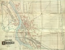
Title: Plan der Stadt Oppeln
Description:
[1] mapa : fotolitografia ; mapa w ramce (w ramie) ; Podziałka liniowa 3cm na mapie = 300 metrów w terenie. Skala 1 : 3350. W lewym dolnym rogu mapy herb Opola. Angefertigt im Jahre 1894 durch den Stadt-Banmeister Schönherr
Publisher:
Place of publication:
Contributor:
Schönherr Stadt-Banmeister. Opracowanie
Format:
Resource Identifier:
Original Identifier:
Language:
Rights Management:
Wojewódzka Biblioteka Publiczna w Opolu
Object collections:
- Opole Digital Library > Recommended
- Opole Digital Library > Cultural heritage > Cartography
- Opole Digital Library > Opole
Last modified:
Nov 16, 2021
In our library since:
May 11, 2015
Number of object content hits:
242
Number of object content views in Mapa format
160
All available object's versions:
https://obc.opole.pl/publication/8049
Show description in RDF format:
Show description in OAI-PMH format:
| Edition name | Date |
|---|---|
| Plan der Stadt Oppeln | Nov 16, 2021 |


