Obiekt
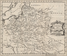
Tytuł: Poland, Lithuania and Prussia
Opis:
[1] mapa : miedzioryt ; 17x20,5 cm, arkusz 20x25 cm ; Cytata bibliograficzna: Mojski, Cartographia Rappersviliana, strona 193 ; Na NE między ramkami: Deg. East from London; na SE między ramkami: Hours East from London ; Pochodzenie mapy: A new Geographical and Historical Grammar: Wherein the Geographical Part is Truly Modern; By Thomas Salomon...engraved by t[homas] Jefferys, London 1758 ; Podziałka liniowa: Scale, Milas 60 to a Degree 120 = [2,8 cm] ; Poniżej podziałki inskrypcja T. Jefferys sculp. ; Podziałka pod tytułem ; Tytuł w kartuszu w środku przy prawej ramie mapy
Wydawca:
Miejsce wydania:
Współtwórca:
Jefferys, Thomas (ok. 1719-1771). Rytownik
Identyfikator zasobu:
Identyfikator oryginału:
Język:
Prawa do dysponowania publikacją:
Wojewódzka Biblioteka Publiczna w Opolu
Kolekcje, do których przypisany jest obiekt:
Data ostatniej modyfikacji:
2023-02-02
Data dodania obiektu:
2023-02-02
Liczba wyświetleń treści obiektu:
3
Liczba wyświetleń treści obiektu w formacie Mapa
0
Wszystkie dostępne wersje tego obiektu:
https://obc.opole.pl/publication/20271
Wyświetl opis w formacie RDF:
Wyświetl opis w formacie OAI-PMH:
| Nazwa wydania | Data |
|---|---|
| 546k zab, Poland, Lithuania and Prussia / T. Jefferys sculp. | 2023-02-02 |


