Object
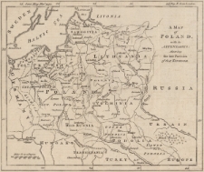
Title: A map of Poland with its Appendages : shewing the late Partition of that Kingdom
Description:
[1] mapa : miedzioryt ; 17x20,5 cm, arkusz 21x26 cm ; Pochodzenie mapy: „The Gentleman's Magazine”, listopad 1772 r. ; Podziałka liniowa: Miles 60 to a Degree 120 = [2,8 cm] ; Verso: blanco ; W górnej ramce z lewej napis: Gent Mag Nov.r 1772, z prawej: Deg E. from London
Publisher:
Place of publication:
Resource Identifier:
Original Identifier:
Language:
Rights Management:
Wojewódzka Biblioteka Publiczna w Opolu
Object collections:
Last modified:
Feb 8, 2023
In our library since:
Feb 8, 2023
Number of object content hits:
55
Number of object content views in Mapa format
0
All available object's versions:
https://obc.opole.pl/publication/20274
Show description in RDF format:
Show description in OAI-PMH format:
| Edition name | Date |
|---|---|
| 552k zab, A map of Poland with its Appendages : shewing the late Partition of that Kingdom | Feb 8, 2023 |


